
RESEARCH COMPANION / MAPS
Historical maps
Maps for reading the geography of the book, with sources and uncertainties identified.
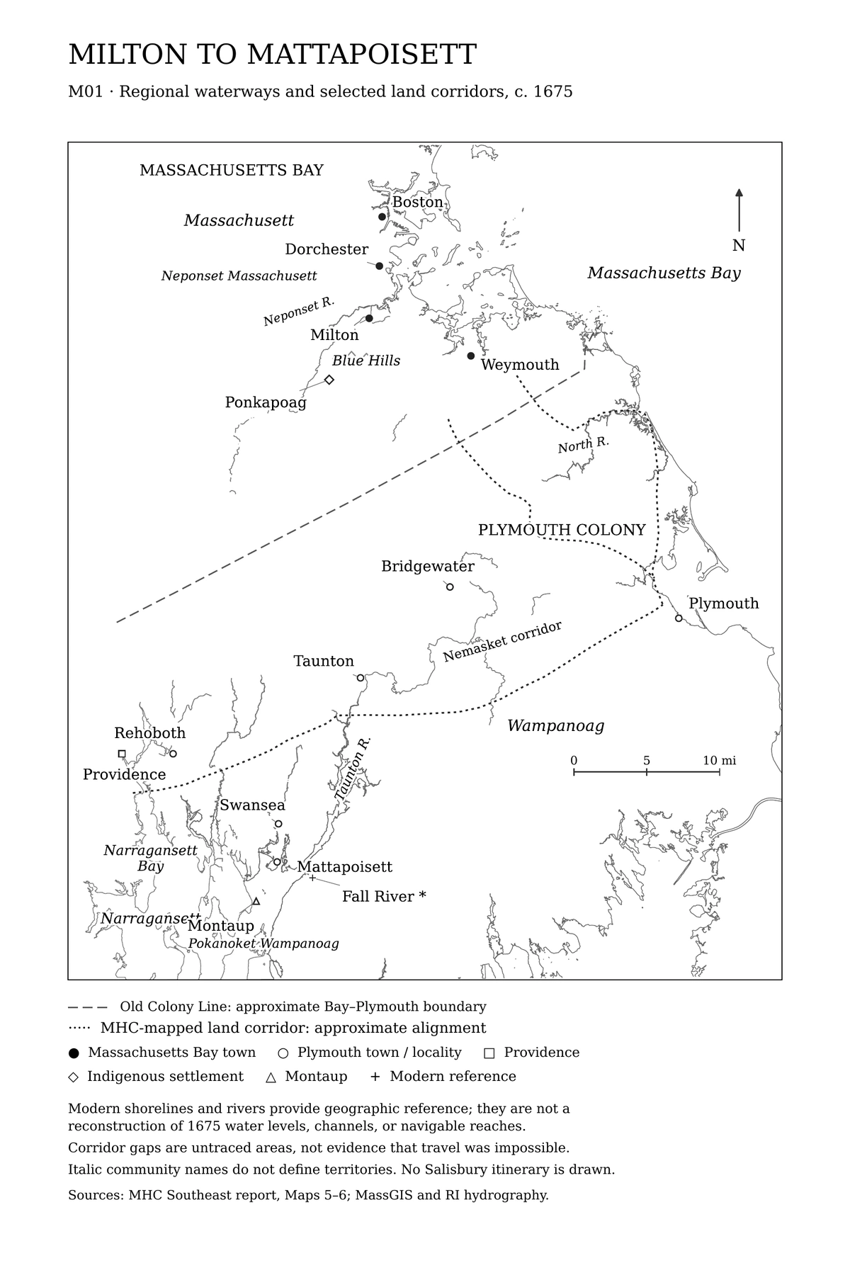
Regional waterways and selected land corridors, c. 1675
The dashed Old Colony Line marks the approximate Massachusetts Bay–Plymouth boundary. Dotted lines show selected historical land corridors. Modern waterways and shorelines provide geographic reference; they do not establish navigability in 1675. Mattapoisett identifies the Swansea locality, not the modern town. No Salisbury itinerary or Indigenous territorial boundary is drawn.
Download the 6 × 9-inch map (PDF)
Map prepared by Second Reading Press (2026). Historical corridors and colonial boundary: Massachusetts Historical Commission, Historic & Archaeological Resources of Southeast Massachusetts (1982), Maps 5–6. Modern geographic reference: MassGIS and Rhode Island hydrography. The boundary is generalized for regional orientation; its placement, particularly toward the western end, is not surveyed precision.
Swansea & Mattapoisett
Town boundaries, settlements, roads, waterways, and locations relevant to June 1675, as documented by source-specific layers.
Milton & Dorchester
The places of William Salisbury’s household, labor, parish, and land records, traced against later maps.
Mount Hope & the wider landscape
Context for the overlapping Native and colonial geographies around Narragansett Bay, with attention to the dates and provenance of each map.
MAP WORKFLOW
Every map needs a date—and a legend.
When available, maps will identify the date of the underlying source, the person who made the modern overlay, the method used to place features, and the approximate nature of uncertain locations.
M01 is a modern interpretive map prepared for the book. Other maps will be added as their source and publication reviews are completed.